Deep Wetlands – Quantifying water extent changes of wetlands with deep learning
Date and time: 28 April 2022, 12:00 – 13:00 CEST (UTC+2)
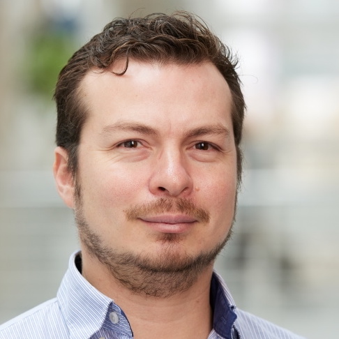
Speaker: Francisco J Peña, Stockholm Universitet, Digital Futures postdoc
Title: Deep Wetlands – Quantifying water extent changes of wetlands with deep learning
Where: Digital Futures hub, Osquars Backe 5, floor 2 at KTH main campus
Directions: https://www.digitalfutures.kth.se/contact/how-to-get-here/
if you are unable to participate onsite, join us on Zoom!
Zoom: https://kth-se.zoom.us/j/69560887455
Meeting ID: 695 6088 7455
Password: 755440
Watch the recorded presentation:
 Abstract: In the Deep Wetlands project we are developing a machine learning platform to monitor water extent changes in wetlands by integrating multiple data sources from satellite images, altimetry radars, and other space sensors.
Wetlands are vital ecosystems for the functioning of the Earth system and necessary to achieve sustainable development. Water availability determines if wetlands can thrive and if they can deliver services to humans. However, water changes are mostly covered by thick vegetation, impairing their remote detection from space. Wetlands are disappearing rapidly; approximately 70% have been lost in the last 120 years.
Despite the danger that wetlands are currently facing, there is no global high-resolution assessment of wetland changes to date. This limits the in-depth and temporal analysis of wetlands from space. Changes in wetlands are unnoticed as most space-based technologies can not fully account for water below vegetation and are limited to large water bodies. Our grand challenge is to quantify the changes in wetland surface area on existing wetlands.
We overcome this challenge in three work packages (WPs):
- WP1: Collect and annotate a diverse dataset of wetland images across multiple world regions and climates.
- WP2: Design an ML model that integrates optical, Synthetic-aperture radar (SAR), and Interferometric Synthetic Aperture Radar (InSAR) images to create an accurate inventory of existing wetlands.
- WP3: Create a tool to visualize the wetland inventory and their changes in water extent over time.
Bio: Francisco J Peña is a postdoctoral researcher working in the field of artificial intelligence and remote sensing. He works jointly at the division of Software and Computer System (SCS) of KTH Royal Institute of Technology and at the Department of Physical Geography of Stockholm University in Sweden. Francisco is also a member of the Distributed Computing at KTH (DC@KTH). Prior to that, he was a postdoctoral researcher at University College Dublin (2018-2020). He obtained his PhD from University College Cork in June 2019.
- Natural Language Processing
- Computer Vision
- Deep Learning
- Recommender Systems
- Remote Sensing


